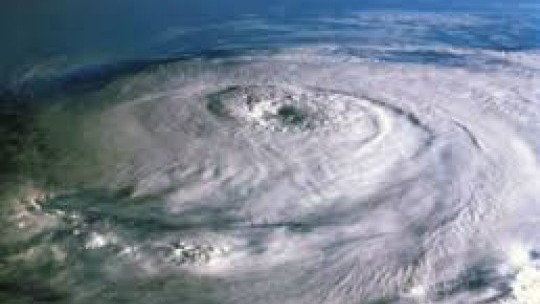
A Hurricane Watch remains in effect for Jamaica as extremely dangerous Hurricane Matthew weakens from a category 5 hurricane to a category 4.
The Miami based National Hurricane Centre in its latest bulletin says the centre of Matthew was located by an Air Force Reserve Hurricane Hunter aircraft near latitude 13.4 North, longitude 73.1 West.
Matthew is moving toward the west near 7 mph (11 km/h).
A turn toward the west-northwest is forecast later today, followed by a turn toward the north-northwest on Sunday.
On the forecast track, the center of Matthew will continue to move away from the Guajira Peninsula this morning, move across the central Caribbean Sea today and Sunday, and approach Jamaica Sunday night and Monday.
Maximum sustained winds are near 155 mph (250 km/h) with higher gusts.
Matthew is a category 4 hurricane on the Saffir-Simpson Hurricane Wind Scale.
Some fluctuations in intensity are possible this weekend, but Matthew is expected to remain a powerful hurricane through Monday.
Hurricane-force winds extend outward up to 45 miles (75 km) from the center and tropical-storm-force winds extend outward up to 205 miles (335 km).
The estimated minimum central pressure based on data from the aircraft is 947 mb (27.96 inches).
Tropical storm conditions are expected to continue in portions of the warning area in Colombia for the next few hours. Hurricane conditions are possible on Jamaica on Monday, with tropical storm conditions possible by late Sunday.
Tropical storm conditions are possible in the watch area in Haiti by late Sunday. Rainfall totals of 2 to 4 inches with isolated higher amounts are expected over Aruba, Bonaire and Curacao through today.
Rainfall totals of 2 to 4 inches with isolated higher amounts are expected along the coast of Colombia from the Venezuelan border to Riohacha.
Rainfall totals of 1 to 2 inches with isolated higher amounts are expected along the coast of Venezuela from Coro to the Colombian border.
Rainfall totals of 10 to 15 inches with isolated maximum amounts of 25 inches are expected across Jamaica and southern and southwestern Haiti.
These rains may produce life-threatening flash flooding and mud slides. Swells generated by Matthew are expected to affect portions of the coasts of Puerto Rico, Hispaniola, Jamaica, Aruba, Bonaire, Curacao, Venezuela, Colombia, and eastern Cuba during the next few days.
These swells are likely to cause life-threatening surf and rip current conditions.


.jpg)

 All feeds